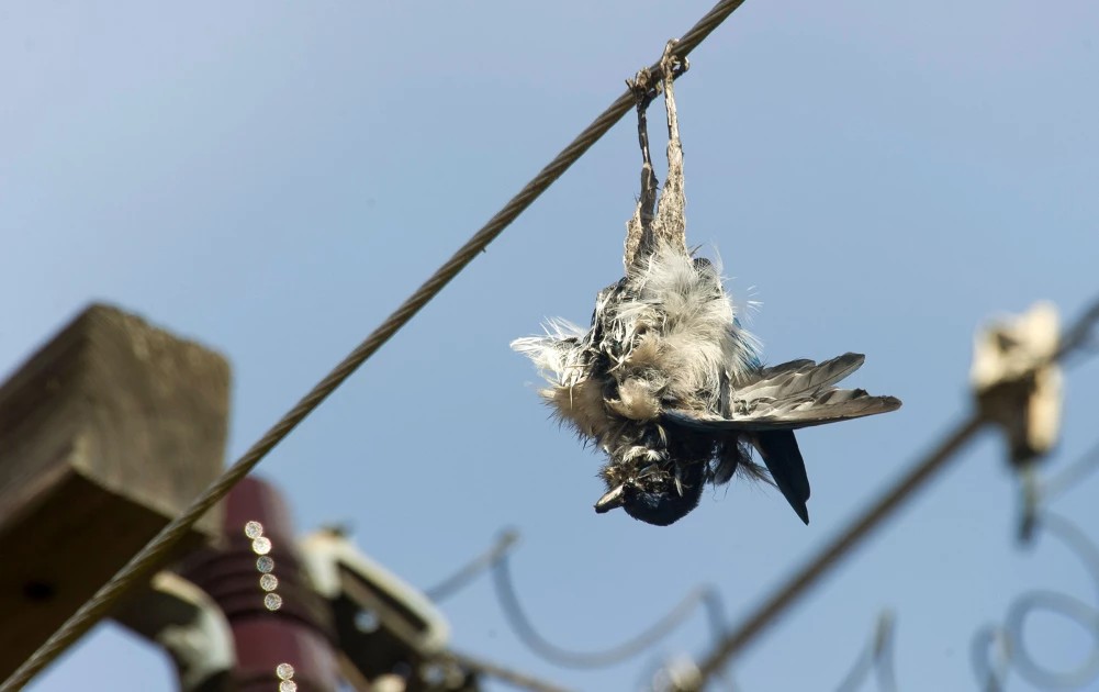
- In Kenya, many bird species including vultures, flamingos and many other migrating birds are threatened by power line infrastructure along the migratory flyways. Power lines are the major causes of collision and electrocution.
A new technology set to help energy developers to identify suitable areas to put up renewable energy infrastructure to avoid killing birds has been launched in Kenya.
The technology, Avian Sensitivity Tool for Energy Planning (Avistep), will help countries that have been mapped as having high incidences of energy infrastructure that affect millions of birds.
The tool has been launched in Kenya, Egypt, Laos, and Uzbekistan by BirdLife International.
Locally, Nature Kenya has been guiding on the development of the tool to help create safer renewable energy development practices in Kenya.
“Each of the new countries—Kenya, Egypt, Laos, and Uzbekistan—is experiencing rapidly expanding energy infrastructure and has significant populations of potentially sensitive bird species,” BirdLife notes.
Read More
The tool is set to curb deaths of millions of birds that are killed along different flyways as they migrate between their wintering grounds and breeding sites.
In Kenya, many bird species including vultures, flamingos and many other migrating birds are threatened by power line infrastructure along the migratory flyways. Power lines are the major causes of collision and electrocution.
According to Paul Matiku, Director at Nature Kenya, the stakeholders in Kenya have already come up with data on bird species that are highly affected by power line collisions and electrocutions in the country.
“This is a ground-breaking tool that will revolutionise how we approach energy planning in Kenya. It will ensure that raptor conservation is at the forefront by identifying key habitats and flight paths of these vital species,” Matiku said.
The new tool provides users with heat maps depicting potential sensitivity of an area in relation to how often the birds use the area. This way, energy developers can be able to minimise the risks and combat bird strikes.
“With this information, we can guide sustainable energy development that minimises risks to raptors and supports their long-term survival,” he said.
Kenya’s Rift Valley, is part of the critical flight path used by migratory birds flying from continent to continent. It is part of the Afro-Eurasian flyway that connects migratory birds flying from Africa, Europe and through Asia.
The flyway along Kenya’s Rift is however threatened by infrastructure including power lines.
With the adoption of the new tool, energy developers and regulators will be able to understand the potential risks posed to birds by certain types of energy infrastructure. This, the stakeholders say, will improve early-stage renewable energy planning.
While countries are in a rush to put up green energy infrastructure, stakeholders observed that there is still little knowledge by developers on the distribution of birds.
“There is incomplete understanding of the factors that make certain bird species more susceptible to impacts from energy infrastructure,” BirdLife says in a statement.
Although birds are critical ecosystem indicators, wildlife poisoning and energy infrastructure threatens them. Birds of prey are also threatened by the expansion of infrastructure.
The new tool has since been used in countries including India, Nepal, Thailand and Vietnam.
At a glance
The Rift valley/Red Sea flyway is the second most important flyway in the world for migratory soaring birds.
Over 1.5 million migratory soaring birds of 37 species use the flyway, including raptors, storks, pelicans, ibises and cranes, of which some are globally threatened are said to be using the routes every year.
Birds are ecosystem indicators of ecosystems.
-1755864575.png)